![]()
![]()
![]()
The goal of od is to provide functions and example datasets for working with origin-destination (OD) datasets. OD datasets represent “the volume of travel between zones or locations” (Carey et al. 1981) and are central to modelling city to global scale transport systems (Simini et al. 2012).
You can install the released version of od from CRAN with:
install.packages("od")Install the development version from GitHub with:
# install.packages("devtools")
devtools::install_github("itsleeds/od", build_vignettes = TRUE)
The examples below provide a gentle introduction to the package. For
a more detailed introduction to the package and OD data in general, see
the od
vignette online at itsleeds.github.io/od or by executing the
following command after installing the package:
vignette("od")You can find descriptions of each of the package’s functions with reproducible examples on the package’s web page: https://itsleeds.github.io/od/reference/index.html
The package originated as a set of functions in the package
stplanr for working with origin-destination data. The
od2line() function, for example, takes a data frame and a
spatial object as inputs and outputs geographic lines representing
movement between origins and destinations:
library(od) # load example datasets
od_data_df # OD data as data frame
#>   geo_code1 geo_code2  all train bus taxi car_driver car_passenger bicycle foot
#> 1 E02002384 E02006875  966    14 153   14         69            18      13  679
#> 2 E02002404 E02006875 1145     6 174   17         96            38      10  798
#> 3 E02006875 E02006875 1791    21  38    5         69             7       8 1637
#> 4 E02006876 E02006875 1035    11 132    6         97            24      10  749
#> 5 E02006861 E02002392  453     1  51    0         51             6      26  317
#> 6 E02006875 E02002392  286     2  15    5         16             2      10  235
#> 7 E02002392 E02006875  753    10  91   21         33             7      19  571
od_data_centroids[1:2, ]
#>    geo_code             geometry
#> 1 E02002407 -1.609934, 53.790790
#> 2 E02002336   -1.62463, 53.88605
desire_lines_stplanr = stplanr::od2line(od_data_df, od_data_centroids)
desire_lines_stplanr[1:2, 1:9]
#> Simple feature collection with 2 features and 9 fields
#> Geometry type: LINESTRING
#> Dimension:     XY
#> Bounding box:  xmin: -1.545708 ymin: 53.7923 xmax: -1.518911 ymax: 53.80925
#> Geodetic CRS:  WGS 84
#>   geo_code1 geo_code2  all train bus taxi car_driver car_passenger bicycle
#> 1 E02002384 E02006875  966    14 153   14         69            18      13
#> 2 E02002404 E02006875 1145     6 174   17         96            38      10
#>                         geometry
#> 1 LINESTRING (-1.545094 53.80...
#> 2 LINESTRING (-1.518911 53.79...
It works great, and is plenty fast enough for most applications, but
there are some issues with stplanr::od2line() (which also
affect the other od_*() functions in
stplanr):
stplanr plus its
numerous dependenciesThe od package addresses the first three of these issues
(it may at some point define a class for od objects but
there are no immediate plans to do so).
The equivalent code in the od package is as follows:
desire_lines_od = od_to_sf(od_data_df, od_data_centroids)
#> 0 origins with no match in zone ids
#> 0 destinations with no match in zone ids
#>  points not in od data removed.
The result is an sfc object that has the same geometry
as the output from od2line:
desire_lines_od$geometry[1:2]
#> Geometry set for 2 features
#> Geometry type: LINESTRING
#> Dimension:     XY
#> Bounding box:  xmin: -1.545708 ymin: 53.7923 xmax: -1.518911 ymax: 53.80925
#> Geodetic CRS:  WGS 84
#> LINESTRING (-1.545094 53.80925, -1.545708 53.79...
#> LINESTRING (-1.518911 53.7923, -1.545708 53.79593)
desire_lines_stplanr$geometry[1:2]
#> Geometry set for 2 features
#> Geometry type: LINESTRING
#> Dimension:     XY
#> Bounding box:  xmin: -1.545708 ymin: 53.7923 xmax: -1.518911 ymax: 53.80925
#> Geodetic CRS:  WGS 84
#> LINESTRING (-1.545094 53.80925, -1.545708 53.79...
#> LINESTRING (-1.518911 53.7923, -1.545708 53.79593)
These are ‘desire lines’ representing the shortest (straight line)
path between two centroids and can plotted using geographic data and
mapping packages such as sf, mapview,
tmap and mapdeck, e.g.:
plot(desire_lines_od)
plot(desire_lines_stplanr$geometry)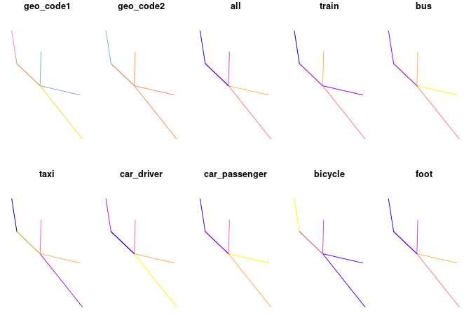
By default the package uses the sfheaders package to
create sf objects for speed. You can can also specify
sf outputs as follows:
desire_lines_od_sf1 = od_to_sf(od_data_df, od_data_centroids)
#> 0 origins with no match in zone ids
#> 0 destinations with no match in zone ids
#> points not in od data removed.nrow(od_data_df)
#> [1] 7
bench::mark(check = FALSE, max_iterations = 100,
stplanr = stplanr::od2line(od_data_df, od_data_zones),
od = od_to_sfc(od_data_df, od_data_zones),
od_sf1 = od_to_sf(od_data_df, od_data_zones),
od_sf2 = od_to_sf(od_data_df, od_data_zones, package = "sf", crs = 4326)
)
#> # A tibble: 4 x 6
#> expression min median `itr/sec` mem_alloc `gc/sec`
#> <bch:expr> <bch:tm> <bch:tm> <dbl> <bch:byt> <dbl>
#> 1 stplanr 5.12ms 5.84ms 171. 607.1KB 4.16
#> 2 od 2.49ms 2.73ms 358. 78.1KB 3.62
#> 3 od_sf1 3.62ms 4.07ms 241. 77.8KB 4.92
#> 4 od_sf2 3.53ms 4.02ms 246. 90.5KB 5.01getLinkLayer()Please note that the od project is released with a Contributor Code of Conduct. By contributing to this project, you agree to abide by its terms.